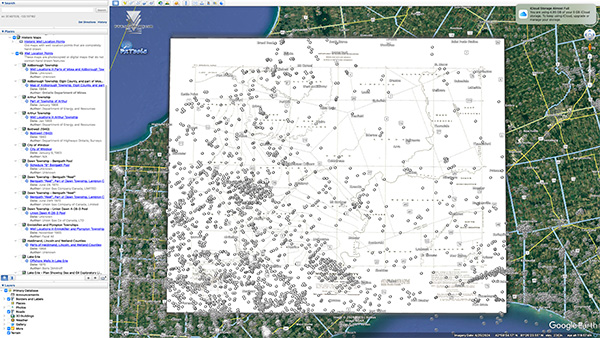
The GIS team has been busy digitizing our collection of historical maps for online viewing. There are over one hundred newly available maps that can be viewed using PxTools, our free plugin for Google Earth, with many more to come. Many of these maps include well point locations.
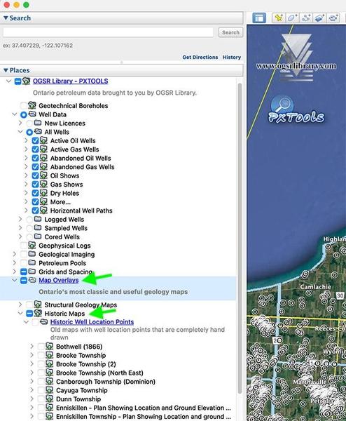
Already using PxTools? Then you can find the
new maps in the Places sidebar menu under Map Overlays--> Historic Maps. No additional downloads required.