|
| OGSR Wireline By OGSR Library September 2024
Edition |
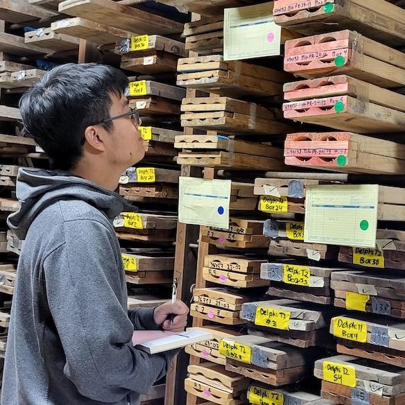
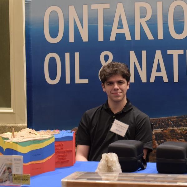
Hi , Each summer the OGSR Library brings a talented group of students on board to digitize new material for our members and help us re-discover our industry. In this newsletter, we’re excited to share the work done by our amazing summer students and team members. New students bring new perspectives, and in their articles, they remind us of what is unique and interesting about the work done in our industry, the interesting things from its past as well as our
potential. One standout achievement this summer has been the inclusion of hundreds of new maps in PxTools, the
Library’s mapping overlays for Google Earth. These historical well location and geological maps can help explorers examine past activity across southwestern Ontario. Hundreds of core photos and chip sample microscope photos were also added and continue to be added each week. All the data in PxTools is linked to our databases and you’ll get the newest updates each time you open it. If you’re not already a user download a copy now to get all our latest mapping overlays at no cost! The team also brought creativity to the table with new medium-sized 3D-printed bedrock
models, virtual reality videos, core piece photogrammetry, and even the development of an online fossil-collecting game, that we can’t wait to share. Updated versions of the Pools and Pipelines map are back, maps covering the years 2020 to 2023 are printed, with the 2024 edition on the horizon for October. A new report on the status of compressed air energy wells in Ontario was compiled and these wells are now distinctly marked on our maps and in search. Find our newest reports in the member download section as they become available. Thank you to our students for pushing innovation forward this year –
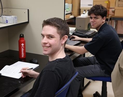
I hope you’ll read below to get their perspectives and find out what else the team has been building! All the best, OGSR Library Team Jordan, Matt, Connor, Oluwatimileyin,
Brian, Melissa, Nolan, Julian |
Models! Models!! Models!!! by Connor |
Cooking in the Cambrian X2 |
Maps Old and New by Oluwatimileyin |
Digitizing Ontario's Rocks by Melissa |
Helping You in the Lab by Brian |
Summer Student Sign Off by Nolan and Julian |
Models! Models!!
Models!!! by Connor |
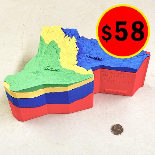
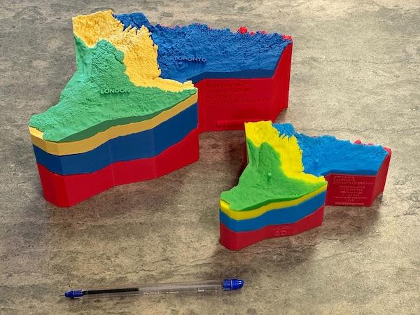
Continuing on this summer’s work, we have designed and begun prototyping the medium-sized Ontario Lithrostratigraphy 3D model. Based on customer feedback, this new version of the model will be larger (we're calling it "medium" sized) and made from less costly material, while still preserving the detail of our original four
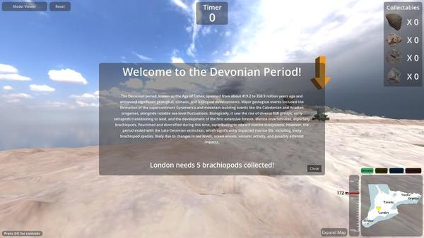
layer resin model. This new model size will come in two different styles. The first one is a simple recreation of our 14 cm resin colour model with different layers representing four major geologic ages. The other one builds upon the four layers by dividing the Ordovician into Upper & Middle Ordovician, and the Silurian into Upper & Middle-Lower Silurian. Additionally, the Cambrian will be represented on the bottom of the Ordovician. Order them today! We’ve uploaded a first look at our virtual geology model & game from this summer! The model can be accessed and played by going to https://geology.games in your computer browser. It currently contains a number of formations from the Devonian & Silurian to explore in the model viewer mode. On the game side of things, we have a simple timed challenge mode available to showcase the gameplay and types of features you can expect to find. We have plans for further updates to the game which will
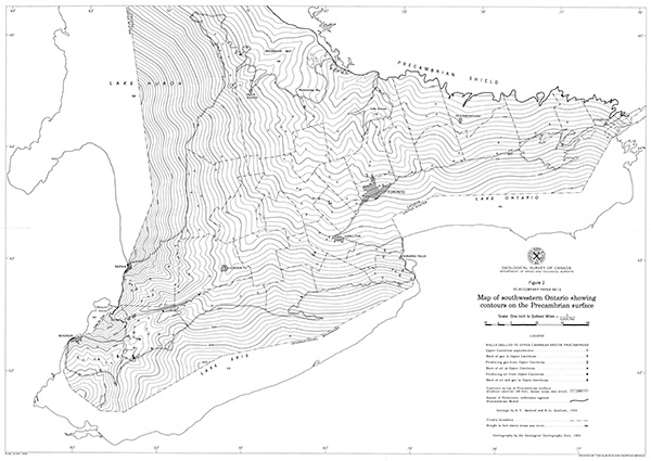
include adding new challenges, new fossils, and a leaderboard so people may compete for first place. Maps Old and New by Oluwatimilayin As a GIS & Database Assistant at the OGSR Library, my role over the past few months has involved a range of tasks. I have been responsible for updating our core analysis database, ensuring that this dataset is current and accurate. This spreadsheet is available on our website in our Members Download page. Additionally, I have worked on digitizing more historical maps from our Brittain collection, and recently for scanned Geological Survey of Canada maps, adding to our collection available online in PxTools for Google Earth. Currently, I
am focused on printing previous pools and pipeline maps using the Canon plotter for the OGSR Library archives, ensuring that they are properly documented and preserved. Alongside these tasks, I am developing a comprehensive guide to streamline and simplify the printing process, making it easier for future employees to efficiently manage map printing. |
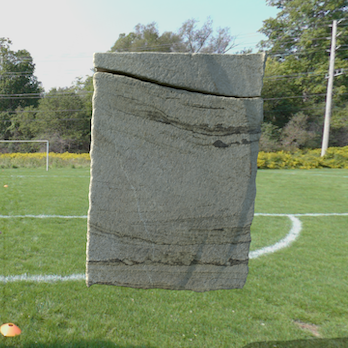
Cooking in the Cambrian x2 By
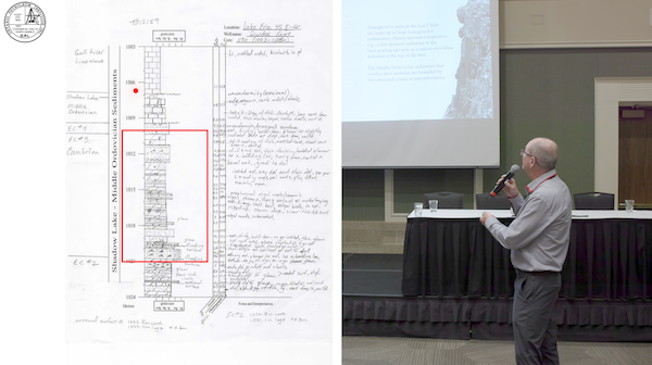
Matt We've been busy cooking up some fresh Cambrian content with two new core workshop videos in two different formats. The Cambrian has seen a lot of interest lately for its untapped resources and energy storage potential. We wanted to strike while the iron's hot, gathering what we know to help with this research and to get
people talking. First, join geologist Ian Calquhoun for the workshop he presented at EPEX 2024. Here Ian offers a detailed history of the Cambrian in Ontario and presents the current understanding of how resource structures were formed, and the potential for storage. This video will have a more traditional live presentation style with
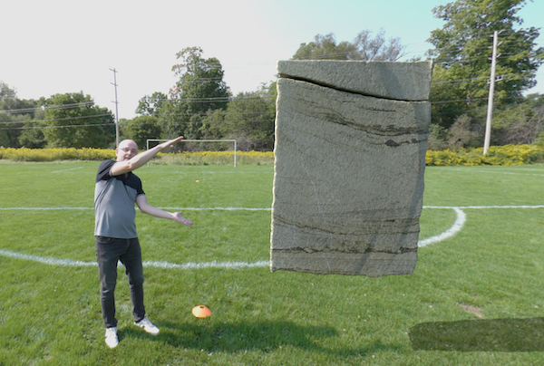
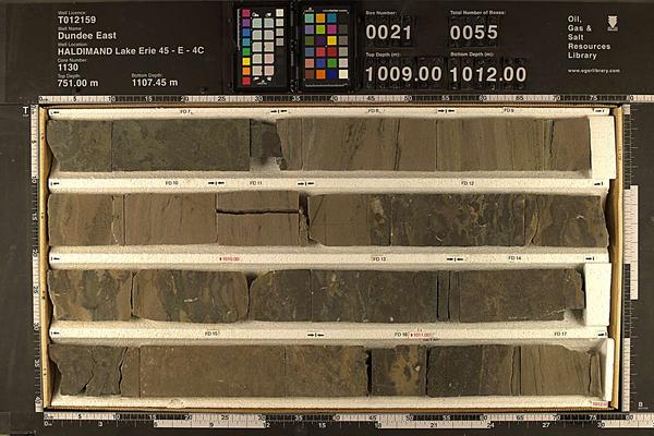
slides, laser pointer, and some rock animations. This video is just about ready for release and will be out before our next newsletter. Those looking for a deep dive into how these rocks were formed should take note. Next we'll be taking Ian to the virtual world with a Cambrian core workshop in 3D. Using accurate 3D models from one of our most popular cores (core # 1130, from well T012159), Ian will guide you through the length of the Cambrian section of the core, examining some of the geological features found in the Cambrian that contribute to its energy storage and resource potential. In the virtual world we can make these core pieces any size, examining them in ways never seen before. Stay tuned for further updates on this
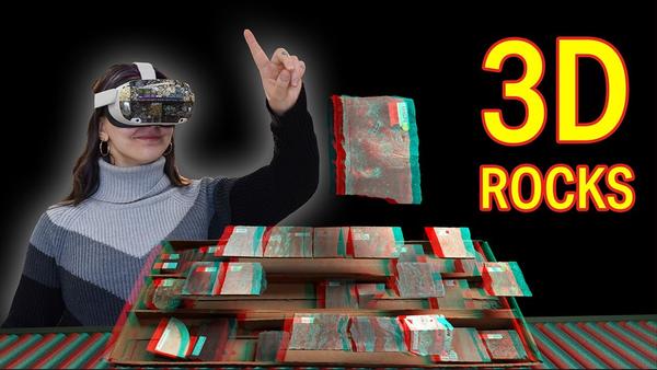
video. In case you missed it, our most recent video release is Rock Core Library - Exploring Subsurface Secrets, where we discuss the importance of rock cores and how they are used by geologists. Featuring accurate 3D models of rocks from our warehouse, 3D microscope images, and even special effects, this video really demonstrates
how far we've come in VR filmmaking. Grab a VR headset and check it out! To browse all of our videos, head over to our YouTube channel. |
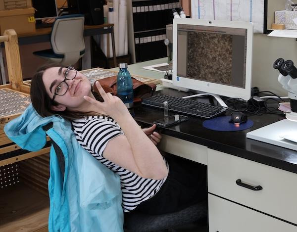
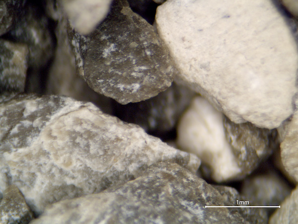
Digitizing Ontario's Rocks by Melissa Hello, my name is Melissa and I'm a GIS and Database Assistant for the OGSR Library. My primary duty this summer was updating the OGSR Library’s collection of chip sample photos and starting from the end of summer I’ll also be updating the OGSR Library’s collection of 3D core pieces with photogrammetry. Since my last update in June many new chip sample photos have been added to the OGSR Library database and can be found on the OGSR Library’s Google Earth PxTools for anyone interested in checking out the OGSR Library’s chip sample photos. The latest samples I've photographed are for
T004985. Next, virtual core pieces made with photogrammetry are another resource that OGSR Library offers in its catalogue. It works by taking photos of each core piece from different angles and a 360 rotation both facing up and down so that all areas of the core piece have their photo taken. Hundreds of photos in total per piece.
These photos are then processed in the Reality Capture software program and aligned together so that the result is a 3D virtual render of each core piece with accurate dimensions. The OGSR Library creates core photogrammetry 3D virtual renders so that viewers can look at core pieces on their devices remotely, and use these 3D virtual renders as part of their research on a core, giving them another avenue to collect valuable data for their projects. Currently the OGSR Library has over virtual 400
core pieces in our database. |
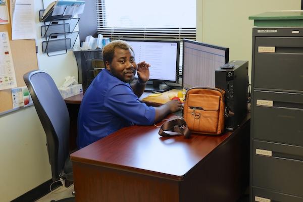
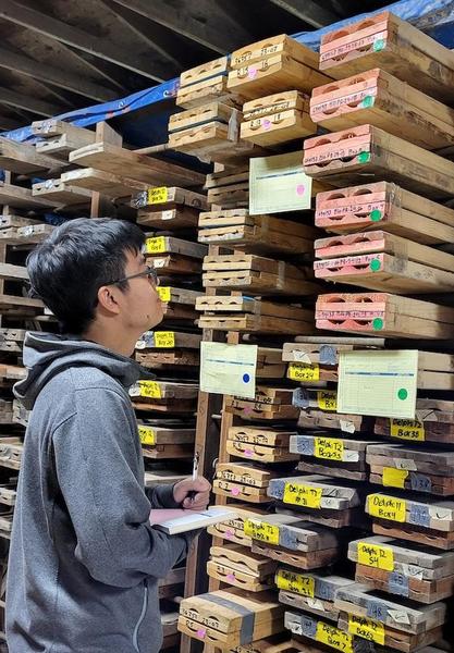
Helping You in the Lab by Brian Hi, I’m Brian, one of the GIS and
Database Assistant of the OGSR Library. Since the last update in June, I have been working on updating the inventory of donated historical maps and well cards on top of the usual well card digitization duty. I have also taken part in taking core photos with our summer students to enhance the accessibility of this library resource and allow our clients to research the core remotely. We recently photographed core 1130 (T012159), that's seen a lot of interest lately. These photos can be looked at in PxTools, our free plugin for Google Earth. Starting from the end of summer, I’ll continue my duty in assisting the library’s clients, but also take up more duties of the core lab. Apart from retrieving core for the clients, I will start to assist clients in sample-related duties such as preparing sample bags for clients and cutting samples from cores for clients for
their geological research. I am excited for the up-coming new duties, and meeting with the new and old clients of the Library to assist them! |
Summer Student Sign Off by Nolan When I joined the OGSR Library as a GIS & Database Assistant, I was unsure what to expect. Over the past 4 months here, I can happily say that I had the opportunity to
work on an incredibly diverse range of tasks, all benefiting my understanding of GIS, geology and the petroleum industry in Ontario. First, I was tasked to georeference the Brittain files, a set of historical maps showcasing the development of the Oil and Gas industry in the province. This initial task provided me with a strong background on concepts that I
would use throughout my time at the library. The maps are now accessible through our website, which can provide beneficial insight to anyone exploring the industry’s history in Ontario. Following this, I had the chance to interact with some of the geological samples in the library. I was able to cut core samples for clients, as well as process cuttings we had received from operators.
Handling these physical samples provided an important understanding of the geology relating to oil and gas production. Interacting with these samples can provide a great oppurunity to anyone interested in geology. Finally, I was able to contribute to the digitization of some assets we hold at the library. I took over 30,000 photos of the Mt. Simon unit of the Cambrian, all being used to
generate 3D models from core samples. Additionally, I photographed over 75 core boxes, which offer the opportunity for remote research of our cores. It was great to be able to contribute to the accessibility of our materials, which can provide new oppurtunities for research that were not previously possible. I will be returning to Western University to
complete my degree in Physical Geography and GIS, with the benefit of the hands-on experience I gained at the library. I would encourage people of any expertise to explore what the library has to offer, as I have seen the great value it has provided me. |
Great Summer
Experience by Julian The summer has come and gone, and my time at the library is coming to an end. Working at the OGSR Library has been a great experience for me, I have been able to learn and improve technical skills and grow my confidence in a work
environment. Before I take my leave, here is an update on the projects I have been working on. Over the summer there have been two projects that I have been focusing on, creating digital models of core pieces using photogrammetry and creating map super overlays. Over the summer, 236 digital models of the core pieces were made, which will be used for virtual
workshops and other projects/outreach in the future. For creating super overlays, I have been using maps from the Brittain archives that have been georeferenced and have been overlaying them in Google Earth. With the help of a few others here at the library there are now just over 200 maps that can be viewed right now in Google Earth using our free downloadable tool, Pxtools! Over the course of the summer, through meeting other people in the industry, working with everyone here at the library, and being able to work on projects pertinent to the industry, my time here has been extremely valuable. Even though I’ve been here the whole summer, I feel like I have barely scratched the surface of what is available here at the library and would highly recommend anyone looking for information for their project take a look at what the library has to
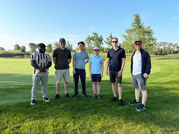
offer. At the Charles Fairbank Oil Properties. Thanks Pat and Charlie! Great to see everyone at the OPI golf tournament! |
Monthly Drilling Report - August 2024 Reporting of new activity
to the end of the month, including past activities reported for the first time in the month by OGSR Library Team |
New Licences Issued for Existing Wells |
Licence No. | Plug Date | Operator | County | Township | Status | TD (m) | T012641 | 2022-03-08 | Imperial Oil Ltd | Lambton | Brooke | OP/ABD | 106.68 | T012688 | 2024-08-09 | MI 637 Inc. | Lambton | Enniskillen | OP/ABD | | T012712 | 2023-10-04 | Imperial Oil Ltd | Lambton | Enniskillen | OP/ABD | 131.37 | T012713 | 2023-09-28 | Imperial Oil Ltd | Lambton | Sarnia | OP/ABD | 143.26 |
|
If you are having trouble viewing this newsletter, it can be viewed here. What is the OGSR Library? The Oil, Gas & Salt Resources Library is a not-for-profit corporation that manages all of Ontario's public drilling and production data from the petroleum and solution mined salt industries. This includes processing, storing, and providing safe and convenient access to all of the industry's drill core and rock cuttings. The Library makes as much of this data as possible
available through our online portal to members all over the world. The financial support of the petroleum industry and our membership make this possible. |
|
|
|