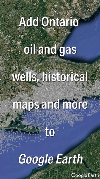
Adding our data to Google Earth is easy! Check out this 1min tutorial video that demonstrates how to install PxTools, our free data layers for Google Earth. Includes over 27,000 wells with links to more information on our website, petroleum
pool shapes, petroleum lot boundaries, historical maps, access to core photos, chip sample photos, logs, and more!